
NASA’s CASALS Tests a Fuller View of Earth in 3D
A new laser-mapping prototype is aiming to fill the spaces between satellite measurements.
NASA’s CASALS prototype is pursuing a more complete three-dimensional view of forests and terrain. An October 21 technology update describes an airborne instrument that steers laser light by changing its wavelength, with further development still needed before a space-ready version.
The engineering idea is unusually elegant. Instead of moving mirrors to point a beam, the system sends different wavelengths through an optical grating. Diffraction directs those pulses to different positions, building a swath of measurements across the flight path. NASA reports that an airborne prototype flew in November 2024; the newly published account should not be mistaken for a satellite launch. Read NASA’s CASALS update.
Why do those measurements matter? A forest has depth as well as an outline. A conventional view from above can show the shape of a canopy, but understanding the distribution of vegetation requires information about height and structure. The University of Maryland’s GEDI mission overview describes laser measurements of canopy height, vertical structure and ground elevation, with applications ranging from forest inventories to wildlife habitat conservation.
GEDI also makes the sampling challenge tangible. Its three lasers generate eight observation tracks. The footprints are approximately 25 meters across, separated by about 60 meters along a track and roughly 600 meters between tracks. Those measurements are valuable, but the spacing helps explain why researchers continue developing ways to observe the areas between them. A reader looking at a finished map should ask which features were measured directly and which were estimated between observations.
Another established example is ICESat-2. Its ATLAS instrument measures the round-trip travel time of laser photons. Combined with the spacecraft’s position, that timing allows scientists to calculate surface heights. The mission splits a laser into six beams arranged in three pairs, a configuration that helps measure slope. Its targets include ice sheets, sea ice and forests, showing how the same basic measurement principle can serve very different scientific questions.
CASALS explores a different way of distributing those measurements. NASA’s update includes a visualization from a November 12, 2024 flight over Delaware’s Great Cypress Swamp. The colors distinguish canopy tops, ground and near-ground vegetation. NASA says wider coverage and onboard processing are among the next improvements; the team is targeting another flight in the ASCENT campaign in summer 2027.
NASA CASALS visualization of Great Cypress Swamp, Delaware, from a November 12, 2024 flight. Credit: NASA.
The broader ASCENT program plans coordinated airborne observations using radar, lidar and stereo imaging. NASA lists campaigns for the East Coast, West Coast and Costa Rica, with the resulting data intended to support science and modeling of space-based performance. Bringing different sensors together also creates an opportunity to compare what each method captures well rather than expecting one instrument to answer every question.
For readers following Earth technology, the useful milestone is a demonstrated prototype with a clearly described next stage. The questions now concern coverage, processing and the transition from aircraft to orbit. More detailed maps will be most valuable when the measurements behind them, and the limits of those measurements, remain just as visible as the finished image. That is a practical standard for judging the promise of any new mapping instrument.
Related Stories to read next from this featured panel!
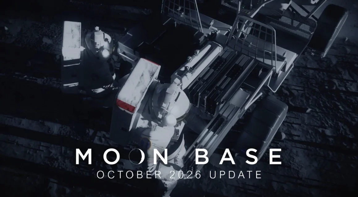
NASA’s latest Moon Base update puts a practical question at the center of lunar exploration: how will people and machines get around? The agency’s October 20 progress report follows a group of rovers being developed to scout terrain, investigate resources and eventually carry astronauts across the lunar surface.

The latest warning is conditional: Iranian officials say communications infrastructure could become a target if Iran faces further attacks.
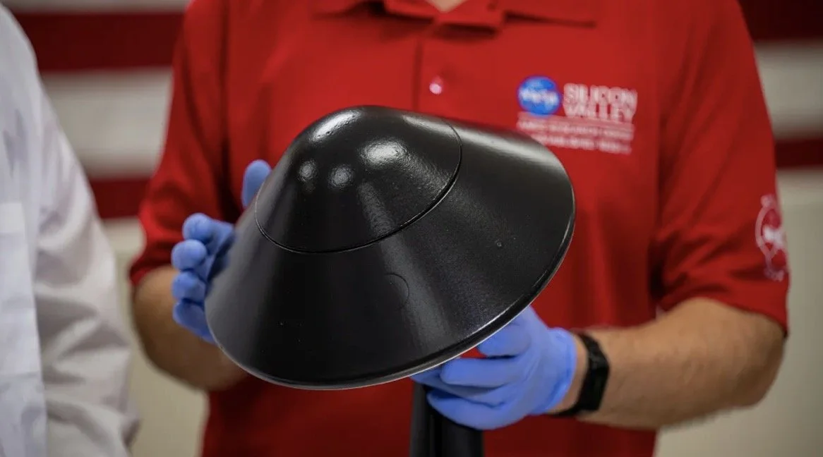
A heat shield’s future may depend on how small it can fold. NASA’s October 9, 2026 update on KREPE-3 highlights a deployable design among experiments intended to improve atmospheric entry.
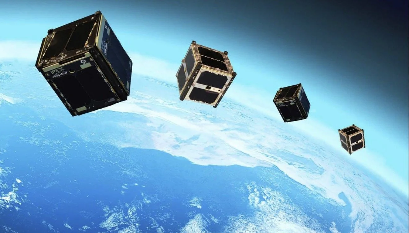
Two student-built CubeSats launched toward the International Space Station on October 13, carrying an idea larger than their compact frames: spacecraft can become a shared learning platform. The PROVES missions put open-source design and experimental radio communications into the same small package.

DARPA’s October 7 quantum-computing announcement puts four more companies into its final verification stage. The next test is whether their hardware can support machines worth more than they cost.

Google begins changing Gemini model access for personal accounts without an AI subscription today, October 9. The rollout gives everyday users a reason to check which model they can use and how their available usage is measured.
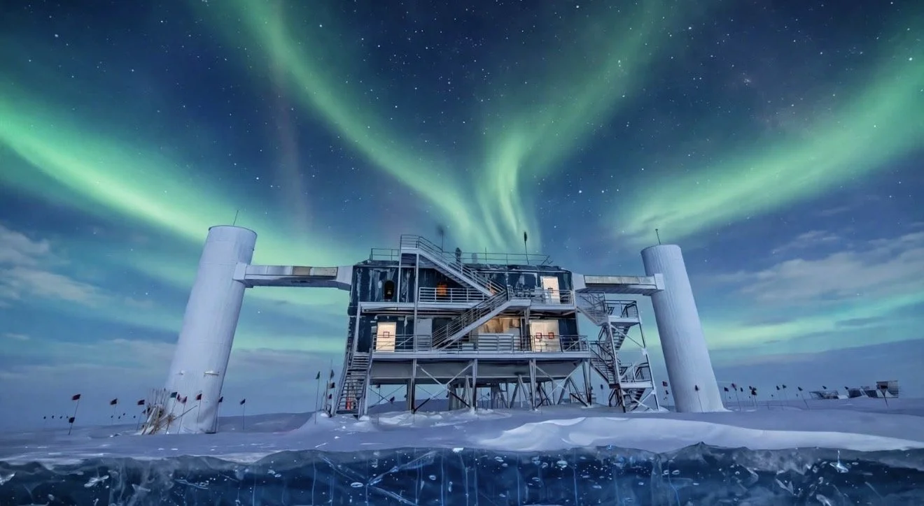
Francis Halzen has won the 2026 Nobel Prize in Physics for his contributions to IceCube and its discovery of high-energy neutrinos from beyond our solar system. Announced on October 6, the award honors a vision that turned a cubic kilometer of Antarctic ice into a telescope and opened a new way to study the universe.
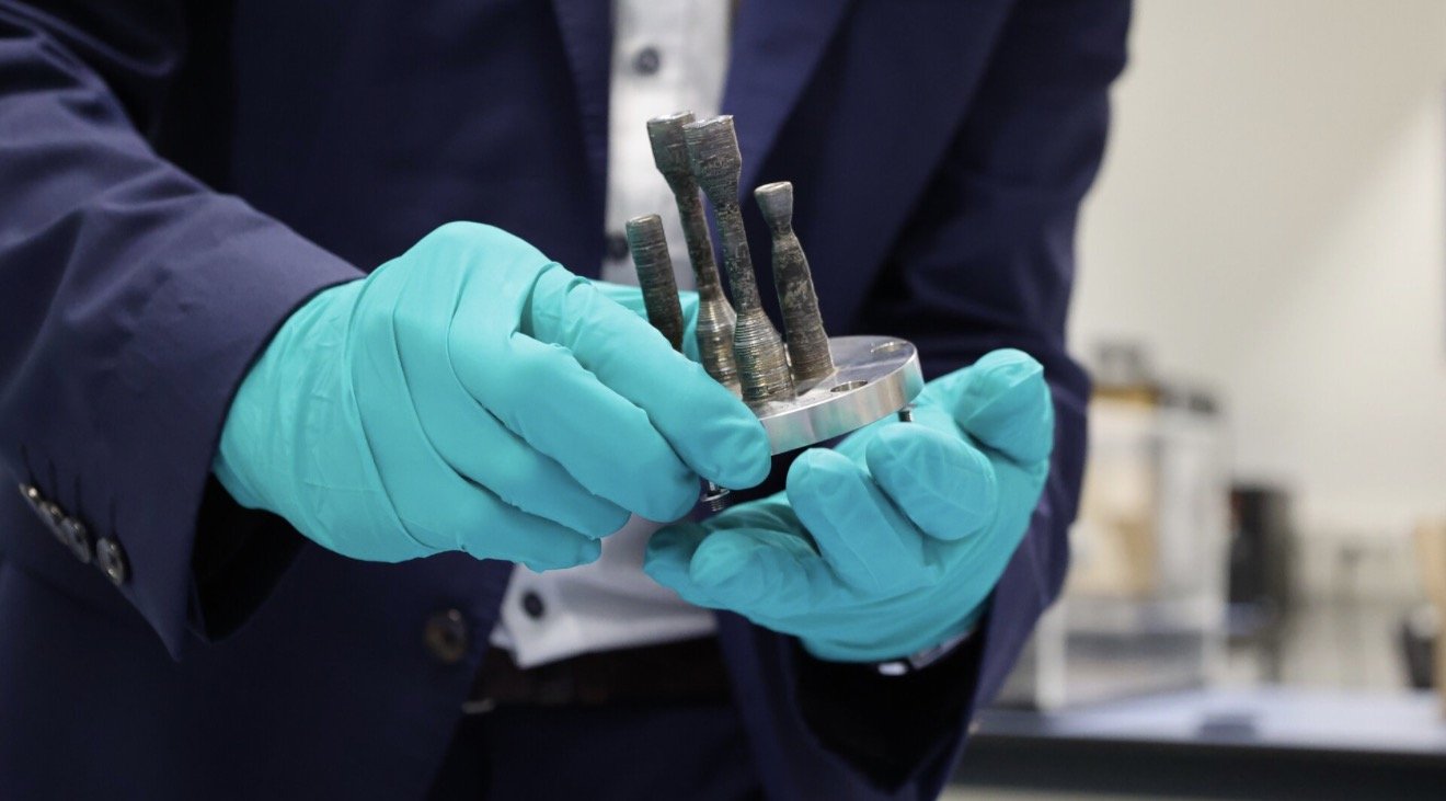
Making a metal object in orbit is a remarkable beginning. The harder question comes when that object has to do a job. ESA’s fifth metal sample printed aboard the International Space Station has returned to Earth carrying two DLR-designed experimental thrusters, the agency announced October 1. Now comes the engineering work that will determine what those small shapes can actually withstand.

This scenario is the most recent in a string of incidents in which American officials claim that drones and missiles fired by Houthi rebels in Yemen, who are aligned with Iran, have collided with destroyers in the Middle East. It also coincides with the spate of attacks against American personnel in Syria and Iraq in recent weeks due to the Israel-Hamas conflict.

It's just food for thought but what if the Apple iPhone 12 gives elemental incentive for other devices like tablets, e-readers, etc. to malfunction or crash indefinitely, hmmm makes me wonder.

The Sony A7 IV is the exceptionally foreseen replacement to the all-purpose Sony A7 III, which was delivered in 2018 yet stays a famous and competent camera.

The mechanical canine, named Spot by maker Boston Dynamics, got the attention of @bloodtear with his weird walk down a sidewalk in northern Ontario, Canada.

PlayStation Plus members will gain admittance to Sledgehammer Games' Call of Duty: WWII as a component of their membership, beginning on May 26.


When Apple at long last unveils its new iPhone 12 models in the not so distant future, we're almost certain they've going to look precisely like what you're going to find in the YouTube video loaded into this article.

Apple and Google shared a considerable lot about their COVID-19 contact detection plans with their joint declaration, however they despite everything left a few holes. Be that as it may, Apple has been happy to fill in a couple of the blank spots in a catch up with press sources.

Bag Valve Mask (BVM) ventilation is a basic crisis expertise, being proposed by New York City Government Andrew Cuomo March 28th, 2020 as a last resort should the Healthcare disaster reach an apex point.

In any case, as numbers climb, human services laborers and state pioneers have sounded the caution on clinical supplies starting to run low. In New York City, presently the focal point of the outbreak in the US, Mayor Bill de Blasio approached Trump for help and said supplies may just keep going for the following hardly any weeks.

"The health and well-being of every person who helps make these products possible is our paramount priority, and we are working in close consultation with our suppliers and public health experts as this ramp continues," the organization said.

The most recent TVs are as a rule outfitted with worked in receivers and cameras, which enable clients to convey directions to the TV or by utilizing facial acknowledgment. With these new capabilities, in that lies the peril for customers and an open door for programmers.

The Air Force is firing up generation of the air-dropped, exactness guided BLU-129 bomb progressively sought after by combat area authorities - so precise, deadly and exact, it is classified “the world’s largest sniper accuracy.”

Apple, the organization that made the present day cell phone, is depending on innovation because clients are as of now very acquainted with, similar to cameras, and assuming a lower priority with regards to cell phone advancement. Be that as it may, could the organization's commitment to well-known innovation be an advantage to the iPhone lineup?

When Facebook first declared it was getting into the crypto business—with an essentially unregulated money called Libra—the response from Wall Street and government investors was about true to form. There was doubt and pushback from the two quarters.

The U.S. national guard spending plan is one of the most enlarged on the planet, with financing surpassing $1 trillion as the Pentagon and barrier industry-accommodating lawmakers look to verify the unchallenged strength of the U.S. Military over the globe.

In front of IFA 2019 in August, Dell declared an invigorate of its XPS 13 workstation with Intel's tenth Gen Core processors — and now the Intel Core i7 model with six centers is accessible for consumers beginning at $999. With those six centers, you can probably hope to see better execution while performing various tasks, however applications should be upgraded to exploit the extra handling force.
Also check out our current Publication “The Aftermath ” Issue available now!

DOSSIER Mining releases in retrograde 'In the Land of Chromatica' with Lady Gaga's Designer Xtian de Medici, Keren Wolf, FX Pose's Naomi Cruz honoring the life of Grandfather Hector of House of Xtravaganza as our 1st cover story & Award Winning Anna Schollerova from Nora K's Whisper Naked Shadow TV mini-series and much much more!! The DOSSIER Mining compared to 'The Aftermath' issue, & others before it, is elevated reaching a better and truer essence of the Cyclolore Brand from many aspects & will so moving forward.
NASA’s CASALS prototype is pursuing a more complete three-dimensional view of forests and terrain. An October 21 technology update describes an airborne instrument that steers laser light by changing its wavelength, with further development still needed before a space-ready version.