
NOAA’s New El Niño Update Raises the Stakes for Winter, Without Settling the Forecast
NOAA’s New El Niño Update Raises the Stakes for Winter, Without Settling the Forecast
NOAA’s November 12 update says El Niño is still strengthening and is likely to remain strong to very strong into January–March 2027. The forecast puts that likelihood above 79 percent, while leaving an important distinction intact: a powerful Pacific climate pattern does not guarantee a particular winter outcome in every city.
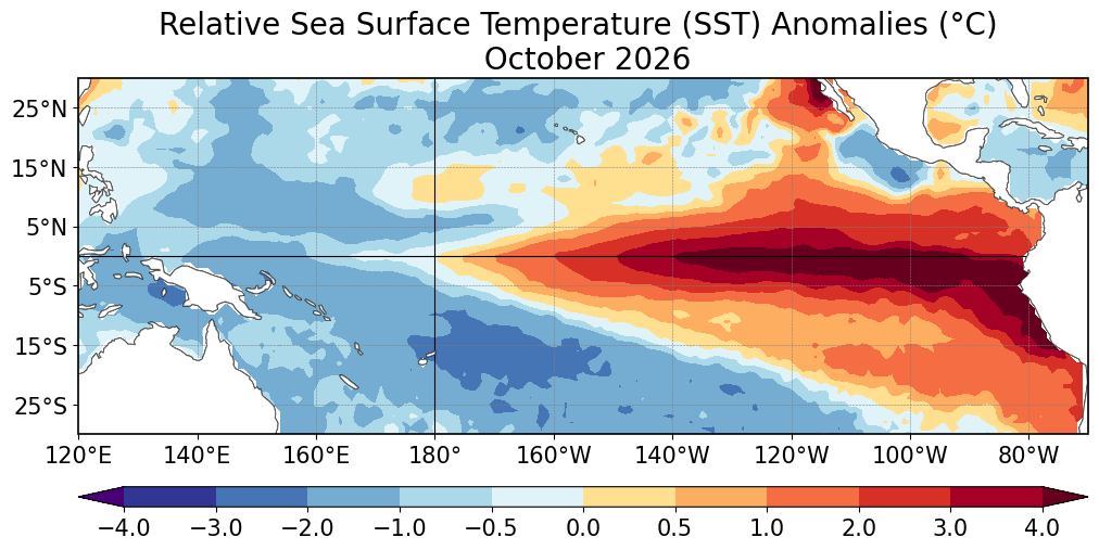
The update also gives roughly a 60 percent chance that the event will reach a historic threshold during either October–December or November–January. That threshold refers to a three-month Relative Oceanic Niño Index value of at least 2.5 degrees Celsius, exceeding previous events in the record dating to 1950. It is a probability, not a declaration that the season has already broken that record. NOAA’s November discussion
How the Pacific changes the forecast
El Niño involves linked changes in the tropical Pacific Ocean and the atmosphere above it. Under typical conditions, trade winds push warm surface water westward. When those winds weaken, warmer water spreads eastward and less cold water rises toward the surface off South America. The consequences can extend far beyond the ocean itself. NOAA Ocean Today
The shifting pattern can alter the jet stream and the routes storms take. That is why forecasts track both sea temperatures and atmospheric behavior instead of treating a single warm patch of ocean as a complete explanation.
What the outlook can tell us
NOAA describes a typical El Niño winter as favoring a more southerly Pacific storm track. Stormier conditions become more likely across the southern United States, while warmer conditions often occur across the northern part of the country. These are broad tendencies, and individual events differ. NOAA background explainer
For a reader in New York, that means the new advisory should inform attention rather than serve as a snowfall prediction. A seasonal climate signal and the forecast for a specific storm answer different questions. A warmer seasonal tendency would not tell you which week might bring snow; a strong El Niño label would not establish the timing or severity of a coastal storm.
Beyond the weather map
NOAA also identifies possible effects on coastal flooding, fish migration and harmful algal blooms. Changes in ocean temperature can influence where organisms move and the conditions in which they survive. Communities therefore have reasons to follow the outlook beyond deciding what to wear this winter.
The November discussion anticipates further strengthening before weakening begins in early 2027. Its next scheduled update is December 10. Until then, the useful approach is to keep the scale of the information clear: use the seasonal outlook for the larger pattern and local forecasts for decisions tied to a particular day.
Thumbnail: Relative sea surface temperature anomalies for October 2026, Figure 1 from the November 12, 2026 ENSO Diagnostic Discussion. Credit: NOAA/NWS Climate Prediction Center. Public-domain U.S. government material. Figure extracted intact from the dated bulletin; page margins and surrounding PDF text excluded. Thumbnail display may crop to fit.
NOAA: El Niño Advisory (2026). Background explanation of El Niño, not the November forecast update.
Also check out our current Publication “The DOSSIER Mining” Issue available now!

DOSSIER Mining releases in retrograde 'In the Land of Chromatica' with Lady Gaga's Designer Xtian de Medici, Keren Wolf, FX Pose's Naomi Cruz honoring the life of Grandfather Hector of House of Xtravaganza as our 1st cover story & Award Winning Anna Schollerova from Nora K's Whisper Naked Shadow TV mini-series and much much more!! The DOSSIER Mining compared to 'The Aftermath' issue, & others before it, is elevated reaching a better and truer essence of the Cyclolore Brand from many aspects & will so moving forward.
Related Stories to read next from this featured panel!
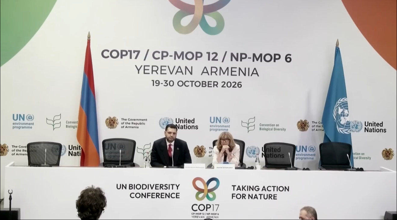




COP31’s presidency is asking countries to support a “35-by-35” electrification pledge, aiming to raise electricity’s share of global final energy consumption from around 23 percent to 35 percent by 2035. Presented at a November 10 press conference in Antalya, the initiative connects the climate negotiations to a practical question: how quickly can cleaner electricity replace fuels in daily life?